
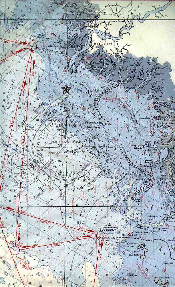
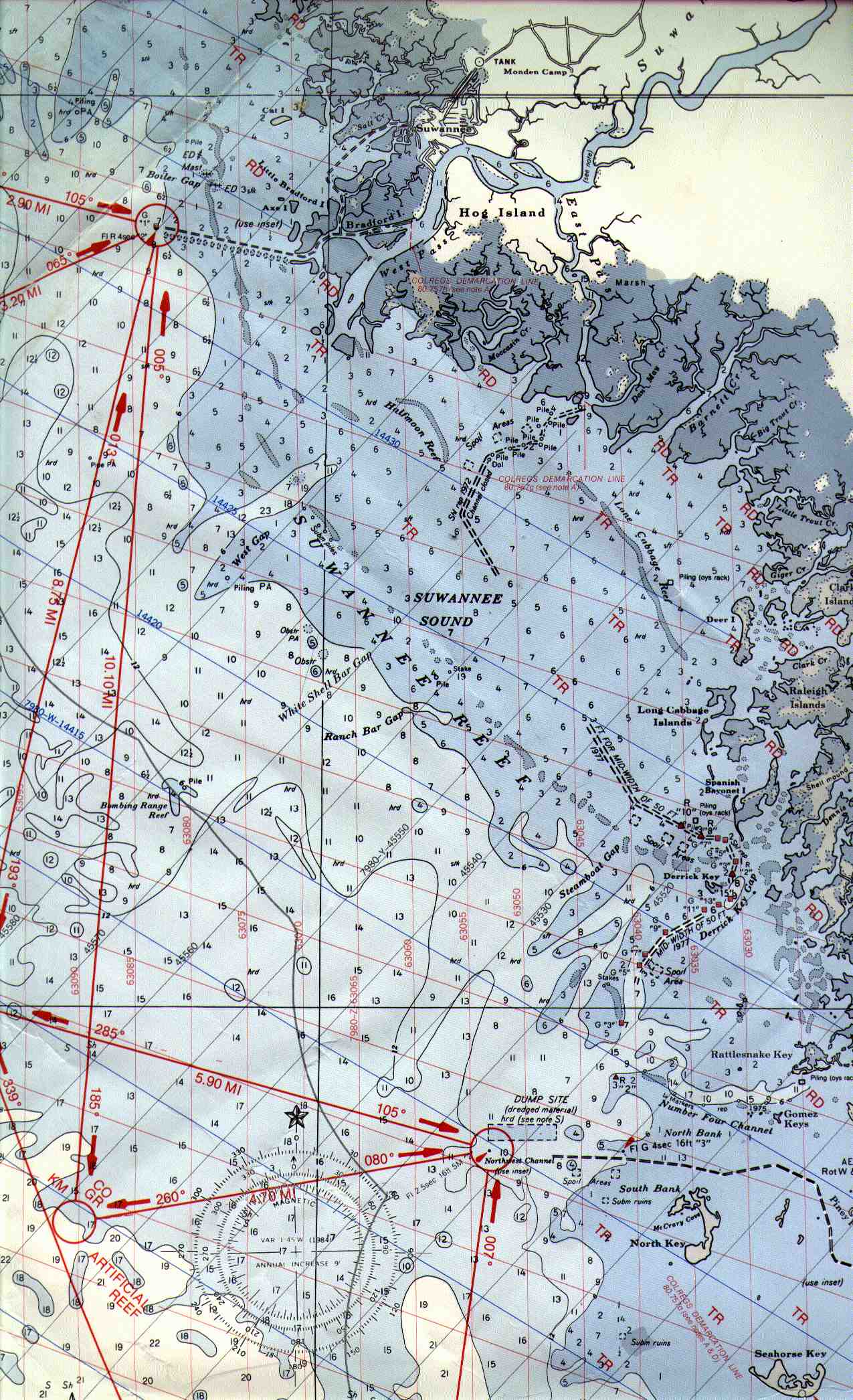
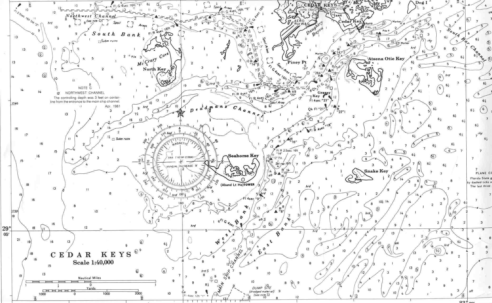
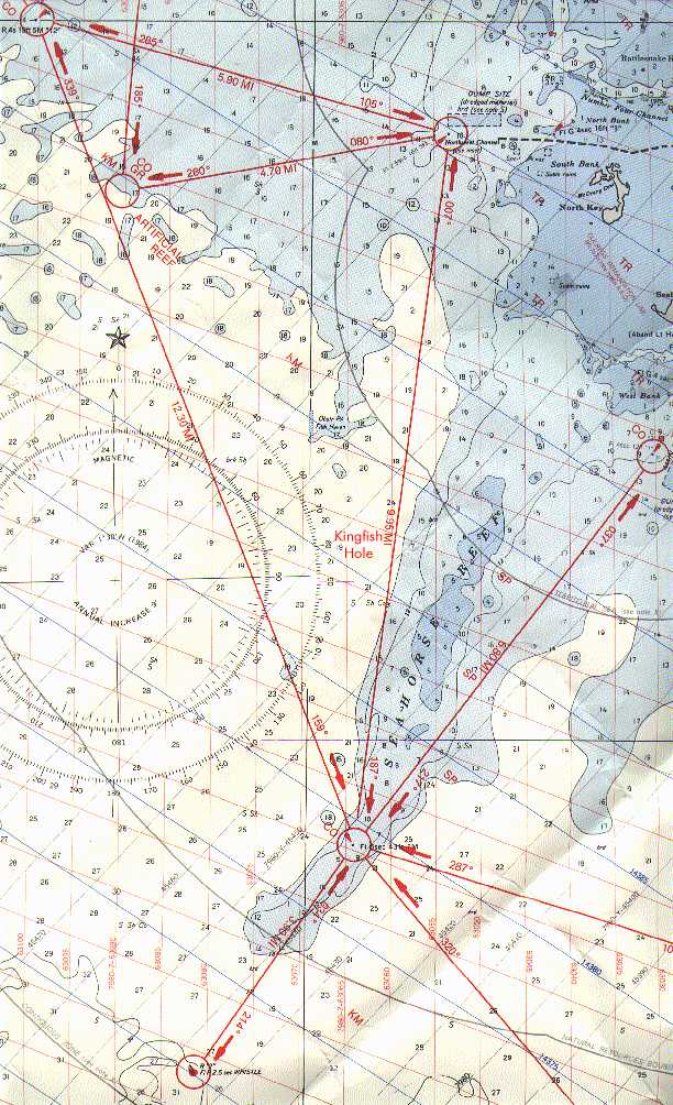
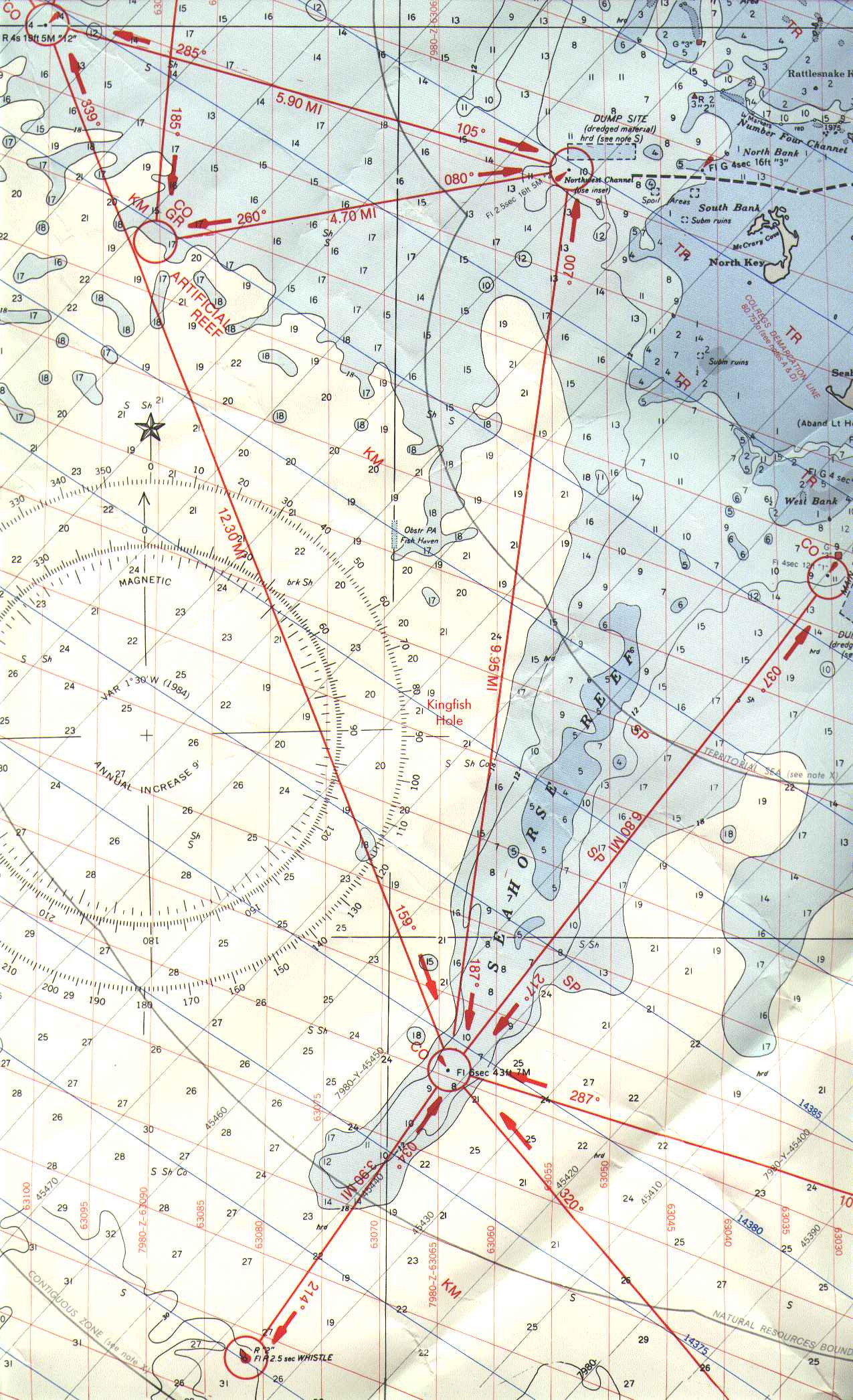
Charts of Florida's Big Bend
These are scanned 8.5 x 14 inch sections of the old, large-format GOFC chart. All images are copyright©
Gainesville Offshore Fishing Club and may be downloaded and viewed or printed only for personal use. These
images may not be used for any commercial purpose, duplicated, or displayed on a Web page except by
hypertext link to the original image contained in the GOFC web site. The images are taken from charts printed
more than 15 years ago and are to be used only for illustration of potential good fishing spots. Under no
circumstances should these charts be used for navigation. The 1993 "Storm of the Century" substantially
altered some channels in the Big Bend region after these charts were printed.
Historically good fishing spots are shown overprinted with red uppercase letters representing the species likely
to be encountered there:
| Code |
Species |
| BL |
Bluefish |
| CO |
Cobia |
| GR |
Grouper |
| KM |
King Mackerel |
| RD |
Redfish |
| SH |
Sheepshead |
| SP |
Spanish Mackerel |
| TR |
Spotted Seatrout |
Courses marked in red between navigation markers are in nautical miles, and course headings are approximate.
The far offshore fishing locations should be used only in good weather and with the proper amount of fuel and
equipment. Some of the inshore locations should be used only after taking into consideration the draft of your
boat and the height of the tide due to the risk of grounding.
Each chart segment covers an area approximately 8 by 15 nautical miles and is available in two sizes in JPG
compressed format. Wherever possible a north up orientation is used. A low resolution (72 dot per inch)
version is suitable for full screen display on most color monitors, but prints poorly. A high resolution (150 dot
per inch) version extends far beyond ordinary screen boundaries, but it can be downloaded and printed or
displayed on a high resolution screen. The high resolution image can be resized to fit onto letter or legal sized
paper using a suitable graphics editor such as Paint Shop Pro or Adobe PhotoShop.
Download GOFC Chart Segments:
- Suwannee Sound. Suwannee River entrance to Cedar Key Northwest Channel entrance. Includes GOFC
Artificial Reef #1.
- Cedar Key Channels. This is a closer-up view of the channels around Cedar Key at a different scale than
the color charts.
- Seahorse Reef. Big Bend Marker 12 to Cedar Key Main Ship Channel entrance, and offshore past the
Seahorse Reef Steel Tower to the Whistle Buoy. Includes GOFC Artificial Reef #1.
Return to Main GOFC Menu