Sprint's agents have claimed that Sprint
has very specific and narrow requirements
pertaining to where they can locate their
new tower.
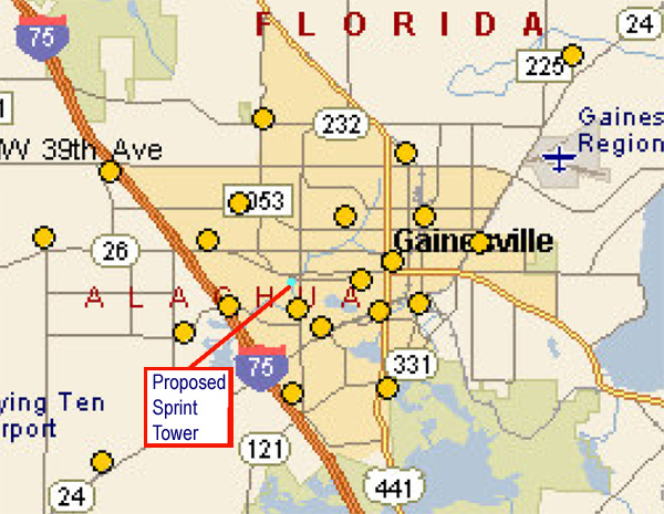
The maps below were extracted from Sprint's
own web pages and show the location of current
Sprint towers in the Gainesville area. The
webpage where these maps was obtained is:
http://www.sprint.com/pcsbusiness/coverage/towermaps2.jsp?cityid=20&city=Jacksonville
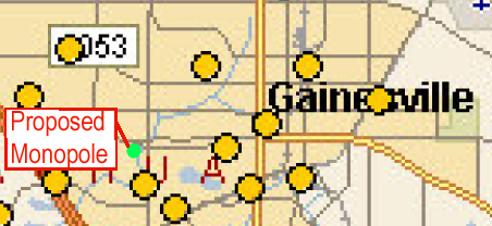
The maps clearly show that the proposed monopole
is in very close proximity to another, already
existing, Sprint site. The orange colored
dots represent existing Sprint towers
Sprint has stated that the tower is required
to fill a coverage hole, however, the map
shows that many locations around the area
have towers much more distantly placed than
Sprint has proposed here. It is unclear that
an additional tower is needed and, even if
Sprint could demonstrate a need in the area,
the proposed site is clearly not even close
to the optimum location for them.